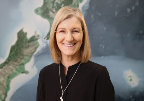
As Chief Executive of Toitū Te Whenua Land Information New Zealand (LINZ), Gaye Searancke leads a team responsible for managing vast areas of land and sea.
New Zealand is a country of abundant natural beautiful and widely varying landscapes, from snowy mountain peaks to fertile farmland, from active volcanoes to pristine sandy shores.
It’s also quite large, with a land area about 15% greater than that of Victoria plus vast oceanic expanses and a substantial territory in Antarctica.
The responsibility for managing New Zealand’s extensive location and property information, cadastral systems, official surveying functions (including hydrographic) and Crown property, belongs to a single government agency known as Toitū Te Whenua Land Information New Zealand, or LINZ.
LINZ is guided by a four-point framework that ensures its mission is aligned with the nation’s needs and priorities:
- To be a respected and honourable Treaty partner with strong and enduring relationships with iwi and Māori.
- To provide trustworthy and reliable geographic and property information that is freely available and well used.
- To be a trusted regulator, delivering fair and transparent systems.
- To ensure Crown estate is well managed, cared for and enhanced for existing and future generations.
We reached out to LINZ’s Chief Executive, Gaye Searancke, to find out more about it and its activities.
How did you get into this field?
I started my career, what seems a very long time ago, as a lawyer in the private sector. I joined the New Zealand public service in a legal role, and it was so exciting (and challenging!) from day one, working on a big range of subject areas and issues. I moved into a senior leadership role mainly because of the belief in me from a wonderful boss, and I was part of leadership teams across a few agencies before I became the Chief Executive of LINZ in 2019. LINZ is such a great agency; we have a long history, our people are dedicated and strongly connected to what we do, and I love being part of the many ways we contribute to New Zealand.
What are your role and responsibilities?
I lead the organisation along with a team of three executive leaders, or Kaihautū. We are focused on being a tight and effective team, leading the just-over 800 people who are part of LINZ.
I also have responsibilities as a public service chief executive as a designated co-lead for diversity and inclusion. We’re responsible for leading diversity and inclusion progress in the public service and supporting chief executives to meet their obligations and expectations under our Public Service Act 2020.

For those unaware, what is LINZ and what does it do?
LINZ is the New Zealand government’s lead agency for property and geographic information. We manage around two million hectares of Crown land, deal with overseas investment applications, and maintain New Zealand’s positioning infrastructure. We have a world-class property system enabling people to own, transact, develop and invest in land and property with confidence. We manage geospatial information, deliver land surveying functions, administer land titles, survey New Zealand’s area of maritime responsibility to create nautical charts, and produce the official topographical maps for the country and some Pacific Islands. In addition, our people support emergency services by making key datasets available and acquiring new data during disasters to aid the response.
We are the sole agency responsible for national mapping, hydrographic charting, and positioning. This is rare and enables us to coordinate work plans and investments, collecting and creating geographic information and making it openly available for others to use.
LINZ is also the home of the Registrar General of Land, Surveyor General, Valuer General and Commissioner of Crown Lands. These four roles, between them, oversee the legal and survey systems that land ownership and valuations rely on. This has enabled forward-thinking initiatives such as the New Zealand Property Spine, which captures common data for every property in the country to support statistical analysis, GIS and planning.
Our joined-up, online, cadastre and land registry streamlines processes and ensures this information is discoverable and accessible. It gives New Zealanders certainty about exactly where their boundaries are when they buy, sell and make use of land. Often referred to as the three Rs: the rights, restrictions and responsibilities of ownership are clearly understood and allow for the efficient use of property in New Zealand. The cadastre provides a robust foundation for government and private individuals to grow New Zealand’s economy, safeguarding $1.62 trillion in residential property assets.
Does LINZ have regional responsibilities?
A range of work extends beyond our shores, in the Pacific and Antarctica.
We produce the official maps of the Cook Islands, Niue, Tokelau and the Ross Sea Region of Antarctica, and we also hydrographic survey and produce nautical charts for those areas, as well as Tonga and Samoa.
LINZ supports and is the secretariat for Ngā Pou Taunaha o Aotearoa, the New Zealand Geographic Board. The Board works on naming places and features in New Zealand and our offshore islands, the seafloor to the limits of our extended continental shelf, and the Ross Sea Region of Antarctica.
LINZ also supports overseas emergencies, using our international connections to obtain satellite imagery for use by other agencies to make assessments about events. We most recently provided satellite imagery of the May 2024 Papua New Guinea landslide to GNS Science (a New Zealand Crown research institute) to support its assessments and aid the response.
How important are international partnerships?
International partnerships are key to our work. We work with other governments’ agencies, intergovernmental organisations and international professional bodies to support and deliver our work.
One of our major projects, the Southern Positioning Augmentation Network (SouthPAN) project, is being delivered in partnership with Geoscience Australia.
We’re also working with our international counterparts to ensure we use the same standards to make timing calculations, which underpin so much of our daily lives. We feed our data into the International Earth Rotation and Reference System (IERS) service, which makes computations that we then add back into our positioning and timing systems, and which better the global system.
LINZ experts contribute knowledge and expertise to several key international bodies. We have people serving on the United Nations Committee of Experts on Global Geospatial Information Management and the UN Group of Experts on Geographical Names. Our hydrographic expertise is recognised through our work with the International Hydrographic Organisation and the South-West Pacific Hydrographic Commission. We also maintain strong professional connections through organisations like the International Federation of Surveyors.
Particularly important are our regional partnerships, including our work with the Australia New Zealand Location Information Council and the Australasian Council of Valuers General. These relationships help ensure consistency across our region and enable us to tackle shared challenges more effectively.
How much of a change will SouthPAN bring?
SouthPAN is already providing benefits to some users, and we expect this will grow to support innovation across many industries including transport, agriculture, construction, forestry and horticulture. The aviation industry is looking forward to adopting SouthPAN to help aircraft land in adverse weather, particularly at our regional airports. Our agricultural and horticultural sectors stand to benefit from improved positioning, with potential to save money and increase productivity. Improved positioning also helps the survey and spatial community with managing assets and supporting compliance activities.
The economic benefits of SouthPAN are estimated to be at least NZ$864 million over the next 20 years. This figure will grow as new technologies and innovations are developed to harness SouthPAN’s possibilities.

What are some of your other projects or activities?
Over the next three years our 3D Coastal Mapping program will map up to 40% of New Zealand’s coastline to understand how it is changing and help our country prepare for the impacts of climate change. We’re mapping the highly populated parts of our coastline, areas with significant coastal infrastructure, and where there is a higher risk of coastal inundation.
LINZ is also capturing bathymetric LiDAR so that we can create detailed 3D maps of the coast and adjacent seafloor. This provides a baseline from which we can measure changes to coastal areas, for example, from climate events and natural hazards such as tsunami and earthquakes.
As an island nation, LINZ’s nautical charts are vital for international shipping. The International Hydrographic Organisation has developed a new global standard (S-100) for digital products, and we’re working with Maritime New Zealand (the maritime safety authority) to deliver a digital navigation framework for New Zealand and our area of hydrographic responsibility. It’s an exciting multi-year program that will deliver up-to-date information in real time, to:
- enhance navigation safety in open ocean and port environments;
- improve efficiency and optimise load capacity for ships;
- plan routes to reduce carbon emissions; and
- pave the way for autonomous shipping and e-navigation.
We are rebuilding Landonline, New Zealand’s digital survey and title information platform. Landonline was a world-first digital survey and title platform, launched in 2000, and it has served us well. New Landonline will be substantially completed by June 2025, and will provide:
- a modular, secure and more adaptable technology platform;
- online, real-time access to property information for the public and decision makers;
- higher-quality survey and title services covering a broader range of transactions; and
- improved productivity and a better flow of information, due to the integration of property data with regimes such as the Māori Land Court’s Pātaka Whenua, an online Māori land portal.
What sort of geospatial challenges does New Zealand face?
The data we deal with is used by many different scientific and research domains, including climate change, forestry, hydrology, and inundation modelling. They all have different data needs and speak different languages, so translating these requirements and meeting expectations is a constant challenge. We regularly review how often we should capture data, and to what resolution. We also come across challenges caused by data gaps, such as when data has not been digitised into usable forms, e.g. historical imagery.
We have programs of work to build geospatial capability, including:
- our Ngā Poutama Matawhenua monthly webinars tailored to provide iwi, Māori Trusts, environmental and conservation groups with tools to access GIS data, map their land and create 3D stories and flythroughs.
- supporting the international Women in Hydrography program by hosting interns at LINZ to learn new skills alongside our experts.
What is something that we might not know about LINZ?
You may not know that we do levelling surveys of historic huts in Antarctica, including Scott’s Discovery Hut, to monitor any movements and ensure their long-term preservation. We also calibrate and make measurements at the world’s southernmost Scott Base tide gauge, ensuring continuity of data at this important site.
Our Surveyor General in LINZ plays an important role ahead of each national election, being part of the team that defines the electoral boundaries.
We measure gravity across the whole country to define the vertical datum, and this data is freely available on the LINZ Data Service.
We also fund New Zealand’s Warkworth Radio Astronomical Observatory that provides Very Long Baseline Interferometry geodetic observations that help measure the size and shape of the Earth to a very high degree of accuracy. Radio-telescopes based around the globe simultaneously observe celestial objects such as quasars, which emit radio waves. Our radio-telescope is one of only 10 such sites in the Southern Hemisphere.
Where can people find more information?
Check out our website and follow us on LinkedIn and Facebook for updates. The LINZ Data Service has its own X (Twitter) profile for data updates. Register with the LINZ Data Service to receive updates on free, open data, including 3D LiDAR of most of the country, historical imagery, surface models etc.
Is there anything else you’d like to convey?
I can’t pass up the opportunity to say how enormously proud we are of our recently retired Chief Geodesist, Graeme Blick. Graeme received the Companion of the New Zealand Order of Merit in the 2025 New Years Honours for services to geodesy, reflecting his 55-year career dedicated to improving the science of geodesy in New Zealand and his contribution to global geodesy. Graeme is an inspiration and role model to many LINZ staff, having followed a specialist career path and having made a lasting contribution nationally and internationally.


