Did you know about these ‘hidden’ gauges that monitor rising Mississippi River levels in Memphis?
MEMPHIS, Tenn. (WMC) - Last Wednesday, April 2, the Mississippi River at Memphis was at a height of 8 feet on the National Weather Service gauge.
As of Monday night, it’s at 28 feet and rising quickly.
The flood stage, when the river starts going over its banks, is 34 feet for Memphis. The Mississippi River is expected to crest at 37.5 feet next Monday.
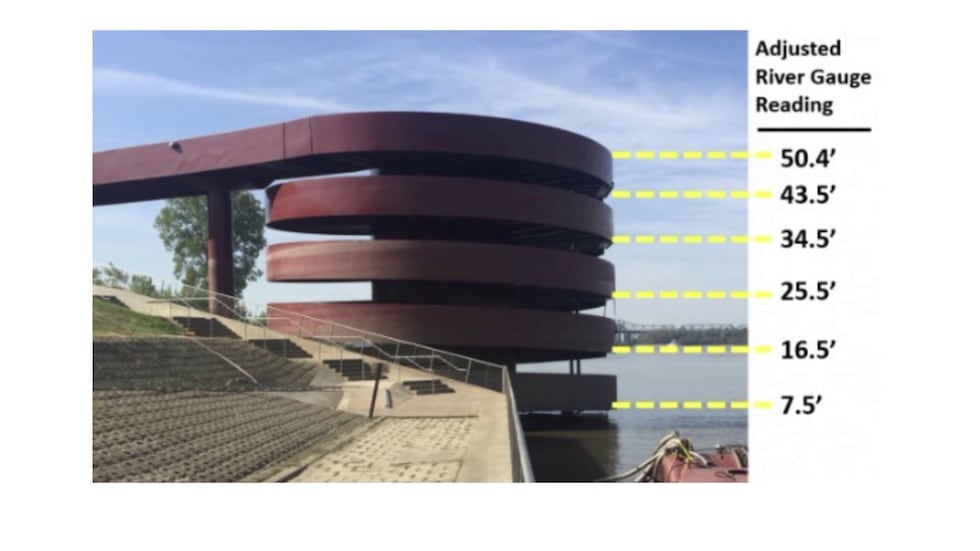
Did you know the spiral boat dock at Beale Street Landing is also an informal river gauge?
This picture shows you the water levels:
And, if you walk north down Riverside Drive and glance over the railing, you’ll see another old river gauge embedded in the historic cobblestones.
That will be underwater by next week; 37 feet goes right up to the wall.
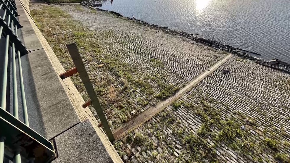
The gauge continues up the wall to 48 feet, which was all underwater in the flood of 2011, when the river rose to 47.3 feet.
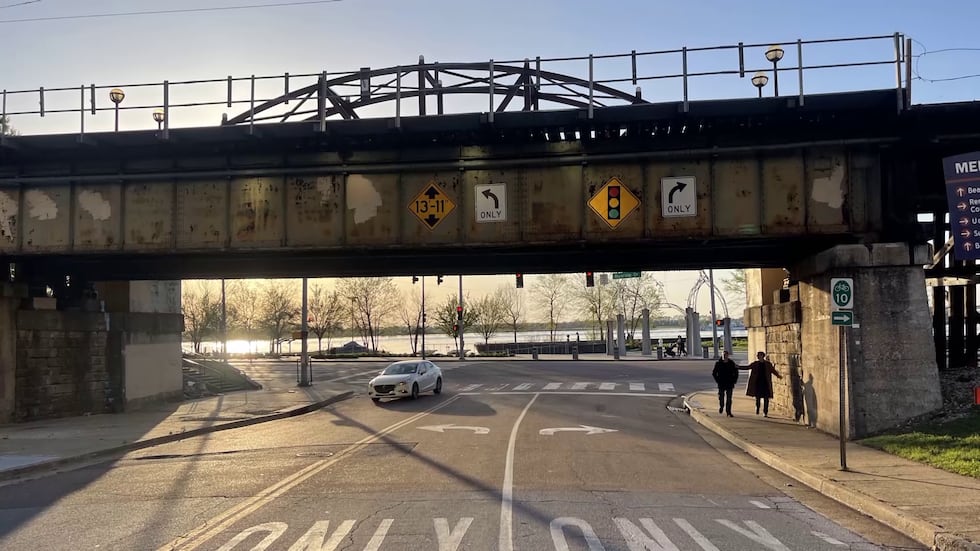
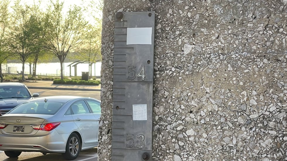
One more gauge lies on the pedestrian bridge over Beale Street at Riverside.
On the right pillar, you’ll see the metal gauge.
The water is not expected to reach this point; that would be historic flooding.
So what will flood when the Mississippi River hits 37.5 feet?
The boat ramps at the north end of Mud Island, the camp near Mound City in Arkansas, and the one on Robinson Road are all at risk to the high water.
Low-lying fields will also be covered. Local tributaries like the Wolf River will also rise as the bloated Mississippi backs up into them.
Click here to sign up for our newsletter!
Click here to report a spelling or grammar error. Please include the headline.
Copyright 2025 WMC. All rights reserved.